-
-
What is a Geopark?
The term "geopark" refers to a unified natural area with a significant geological heritage. To be recognized as a geopark, an area must promote the study and conservation of its geological and cultural heritage and the ecosystems this legacy supports, and also apply knowledge of its geological past in local industries and education. Geoparks invite visitors to learn about the long history of our planet and discover how this history relates to the nature, lifestyles, and cultures we see today.
About Tosashimizu Geopark
The city of Tosashimizu spreads out on both sides of Cape Ashizuri in southern Kochi Prefecture. It occupies land formed by tectonic and magma-related activity millions of years ago, and has a mild climate thanks to the warm Kuroshio, also known as the Japan Current, which flows north from the East China Sea along Japan's Pacific coast. This combination of tectonic and oceanic forces gave birth to the seaside landscape and ecosystems that have provided a livelihood for the local people, who have practiced fishing and agriculture here for centuries. Tosashimizu works to conserve and highlight this unique natural environment and the seaside lifestyles it supports, and to pass the legacy on to future generations.
The Geological Origins of Tosashimizu
The land that is now occupied by Tosashimizu was formed when deep-sea sediment was pushed upward by the interplay of tectonic plates over tens of millions of years. In addition, the geological strata in the Tatsukushi and Ashizuri areas bear marks from 15 to 20 million years ago, when land at the edge of mainland Asia broke off into the ocean and formed the Japanese archipelago. The land that was fashioned in this great upheaval continues to be shaped by the movement of tectonic plates, as well as by weathering and erosion.
-
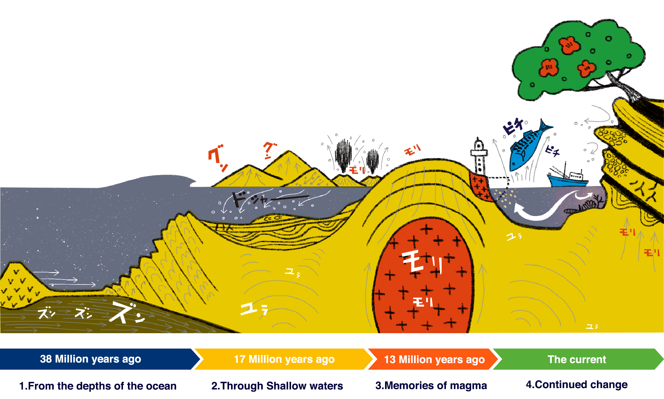
1 From the depths of the ocean
38million years ago~The land that present-day Tosashimizu stands on began to form approximately 38 million years ago as a result of the movement of tectonic plates. An oceanic plate descended beneath a continental plate, a process that over some 21 million years gradually caused sediment from the oceanic plate to come loose and accumulate onto the continental plate. A new geological body, a so-called accretionary wedge, slowly formed at the tip of that plate. As the accretionary wedge grew, parts of it gradually emerged from the ocean to form new land.
Kanaezaki Point
-
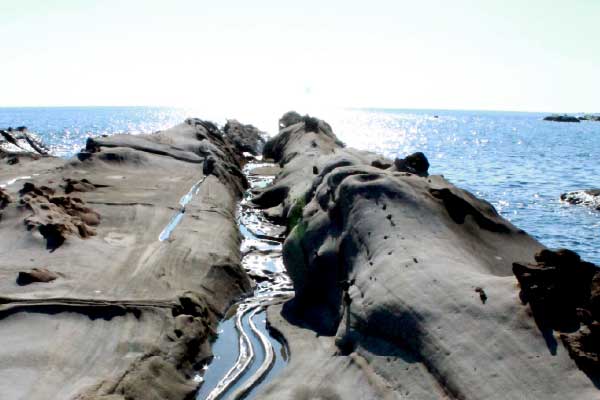
2 Through shallow waters
17million years ago~As the accretionary wedge grew, shallow seas materialized along the edge of the continental plate. Sand and mud began to accumulate in these coastal waters approximately 17 million years ago, gradually hardening into new geological strata. These strata are collectively known as the Misaki Group and took shape around the time when land at the edge of mainland Asia broke off into the ocean and formed the Japanese archipelago. The Misaki Group contains traces of this great upheaval, and is a source of significant interest for geologists. The strata offer a chance to study what the environment around the Japanese islands looked like at a time when the archipelago was still moving toward its current position.

Tatsukushi Coast
-
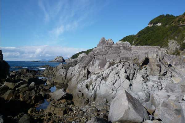
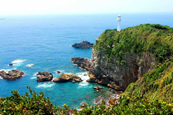
3 Memories of magma
15million years ago~Some 14 million years ago, after the Japanese islands had reached their current location, magma began to spout from the depths of the earth in parts of what is now western Japan. Some researchers posit that this magma formed the basis for many of the region's mountains and for the numerous capes that protrude into the Pacific Ocean along the coast of Shikoku. The tip of one of these peninsulas became Cape Ashizuri, whose granite cliffs consist of magma that consolidated deep underground during this time. The various properties of rocks in these cliffs resemble those in far older, continental rock. This similarity holds promise for scientists who hope the cliffs of Cape Ashizuri could one day help them understand how continents are born.

Cape Ahizuri-misaki
-
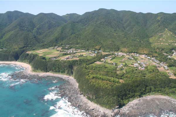
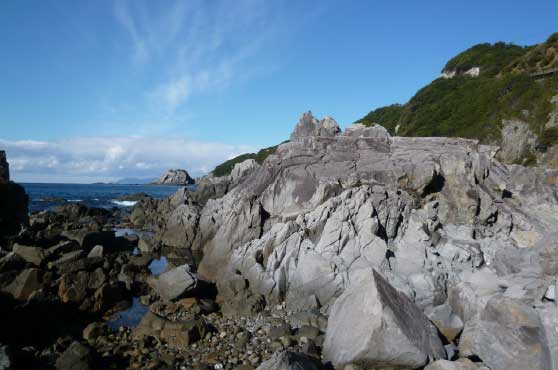
4 Continued change
The currentThe primordial land formed by the interaction of tectonic plates continues to be affected by geological forces, as do the strata that took shape after the Japanese islands broke off from the edge of the Asian continent and the consolidated magma that turned into granite. Magmatic and seismic activity alter the landscape, as do weathering and erosion, keeping the geologically diverse land of Tosashimizu in constant flux.

Coastal Terraces in Tsuro
-Living with the Kuroshio-
the story of the land where fishermen are born
The Kuroshio and Local Culture
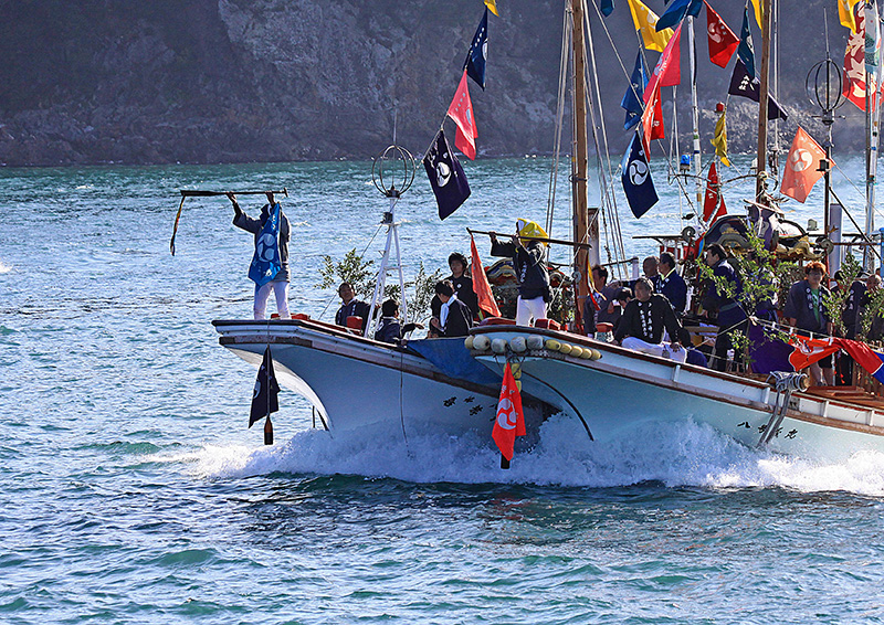
Life in Tosashimizu is inseparable from the sea. Historically a shipping hub, the city is now a major destination for marine tourism and remains one of the best places for fishing in all of Japan. All this is made possible by the warm Kuroshio (Japan Current), which flows north along the Pacific coast of Japan. Its presence has allowed the local people to develop not only a diverse food culture but also a lifestyle in which coexistence with and gratitude toward the sea play a central part. These principles have been passed down from generation to generation, and continue to influence daily life in the area.
Blessings of the Kuroshio
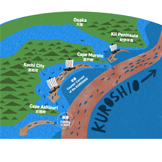
Fishing in the Tosashimizu region benefits greatly from the Kuroshio. When the current collides with Cape Muroto and the Kii Peninsula further east, it forms so-called reverse currents. Combined with the distinctive underwater topography just off the coast, they create ideal conditions for a wide variety of fish species, including skipjack and bullet tuna traveling on the current. This abundance provides a livelihood for local fishermen and has made Tosashimizu famous for its fishing culture.
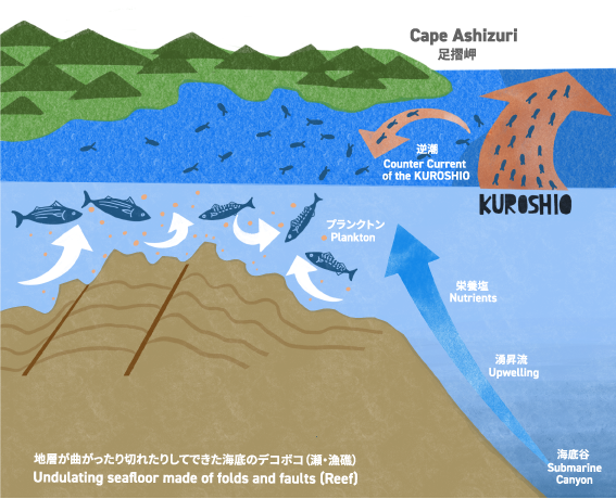
The Kuroshio and the Land
Both the natural environment of Tosashimizu and most of the lifestyles in this region have their origin in the interplay between the warm Kuroshio (Japan Current) and the local topography. The seafloor right outside Cape Ashizuri is uneven--a result of the diverse bedrock and marine erosion. When the Kuroshio collides with depressions in the ocean floor, accumulated nutrients swirl upward, attracting an abundance of fish.
Tatsukushi Bay, which is distinguished by its many asymmetrical inlets, was formed because the geological strata here are vulnerable to weathering and erosion. The diversity of corals and other marine life found in the bay is another result of the Kuroshio's ceaseless flow along the coast, where the landscape has been a source of wonder for visitors at least since the Edo period (1603-1868).
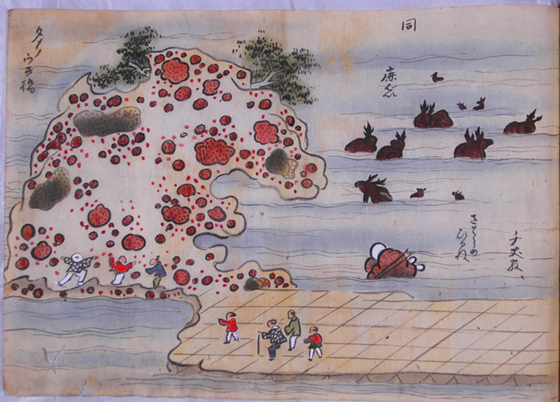
Edo period drawing of the Tatsukushi coast.
(From the Museum of Ehime History and Culture collection)